The impact of Mount Ruang‘s eruption in Sulawesi damaged hundreds of houses. The National Disaster Management Agency (BNPB) recorded that 498 houses and three public facilities were destroyed.
“The number was obtained based on the recapitulation results carried out by the disaster emergency management team on the fourth day or Saturday (20/4),” said the Head of the BNPB Disaster Data, Information, and Communication Center, Abdul Muhari.
He explained in detail that the material losses included 135 lightly damaged houses, 363 medium-heavy damaged houses, two churches, and one elementary school building in Tagulandang, Sitaro Islands.
In a video taken from YouTube TVOne, the damage can be seen from the stones that fell and penetrated the roofs of residents’ houses.
Some residents who returned home after evacuating began cleaning up the remaining damage inside the house.
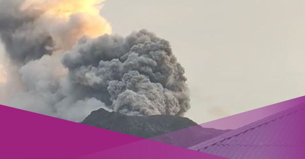
Currently, the status of the mountain has changed to safer. But there are still small eruptive movements.
Some residents have started to return home from evacuation centers.
However, the government recommends that people around Mount Ruang remain vigilant and do not enter the 4 km radius area from the center of the active crater of Mount Ruang.
Residents living in the Tagulandang Island area within a 4 km radius should immediately evacuate to a safe place outside the 4 km radius. The public is also advised to always wear masks to avoid exposure to volcanic ash that can interfere with the respiratory system.
Tsunami Potential Due to Mount Ruang Eruption Officially Revoked
The Geological Agency of the Ministry of Energy and Mineral Resources (ESDM), through the Center for Volcanology and Geological Hazard Mitigation (PVMBG), revoked the recommendation for the potential occurrence of tsunami waves that may occur due to the eruption of Mount Ruang on Sunday, April 21, 2024..
However, PVMBG still requested that residents on Tagulandang Island, especially those who live near the beach, be aware of the potential for incandescent rock ejections and hot clouds (surge).
Regarding Mount Ruang’s activity, Wafid explained that during visual monitoring on April 21, 2024, until 12.00, WITA observed white main crater smoke with thick intensity, a maximum height of 200 meters from the peak, and no eruption. This shows a decrease in eruptive activity on Mount Ruang.