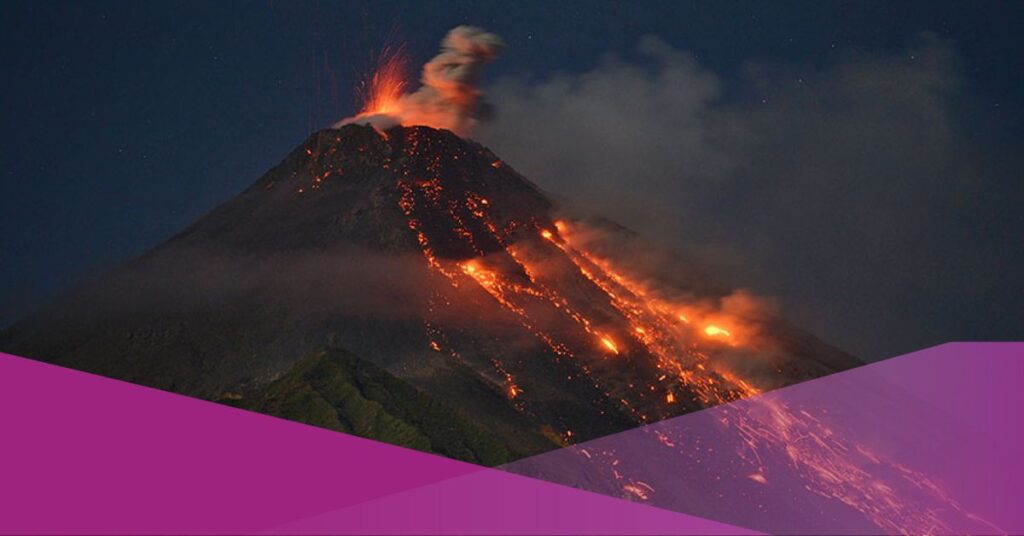
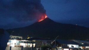
According to the Volcanology and Geological Disaster Mitigation Agency (PVMBG), Mount Karangetang is still at level III of alert in the North Sulawesi Province’s Siau Tagulandang Biaro Islands District. “We expect the residents to comply with the appeal regarding the dangerous zones or recommendations issued by the PVMBG,” said Yudia Tatipang, head of the Karangetang Volcano Observation Post, on Sunday, 16th April 2023.
According to the observation on Sunday from 00:00 to 06:00 Central Indonesia Standard Time (WITA), Mount Karangetang summit was visible while occasionally obscured by fog. He said that weak-pressure, light to medium-white smoke was spotted rising 50 meters from the main crater throughout the monitoring time.
Check out Mount Karangetang update here
The secondary crater emitted thin to thick white smoke, with a maximum thickness of roughly 25 meters. Additionally, flames that erupted at the height of 10 m from Mount Karangetang summit of the main and minor craters were visible thanks to the security cameras (CCTVs).
A shallow volcanic quake with an amplitude of 8 mm and a length of 5 seconds at Mount Karangetang was also reported by the Karangetang Volcano Observation Post, along with seven hybrid volcanic earthquakes with amplitudes of 5-8 millimeters and durations of 10–24 seconds.
The report also noted four distant tectonic earthquakes with amplitudes between 8 and 35 mm and durations between 44 and 89 seconds, as well as one local tectonic earthquake with an amplitude of 35 mm and a length of 20 seconds.
In the south and southeast sectors of the volcano, Tatipang pleaded with the local population, tourists, and climbers to refrain from engaging in any activity within a 2.5-kilometer radius of the main crater and a 3.5-kilometer radius of Mount Karangetang summit.
Additionally, locals surrounding the mountain are urged to maintain their composure and avoid becoming agitated by erroneous information about Mount Karangetang’s eruption. The general population should constantly follow the Sitaro Islands District BPBD and the North Sulawesi Provincial Regional Disaster Mitigation Agency (BPBD).
Furthermore, those who live along the river’s banks must be cautious of potential lava flows during the rainy season because the river comes from Mount Karangetang’s summit. After exhibiting increasing volcanic activity, the 1,784 meters high volcano erupted effusively on 8th February 2023.
Interested about this topic? Check out our other articles: