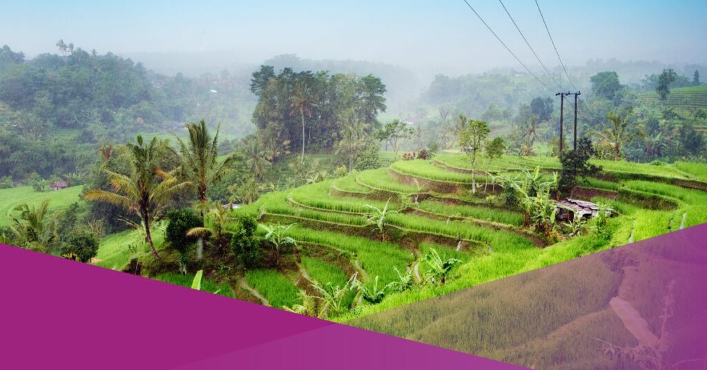
Bali has experienced significant land conversion over the past six years, with 6,521 hectares of rice fields disappearing between 2019 and 2024. The Bali National Land Agency (BPN) reported that the overall decline in rice fields reached 9.19 per cent during this period, averaging 1.53 per cent annually.
“In essence, in six years there has been a reduction of 6,521 hectares (ha) of rice fields,” said I Made Herman Susanto, Head of Planning and Empowerment of the Bali Regional Office of the BPN, during a meeting with the Bali Regional Representative Council (DPRD) in Denpasar, as quoted by Detiknews.
Denpasar City recorded the highest level of conversion, where 38.83 per cent of rice fields disappeared over six years, averaging 6.34 per cent annually.
“Over the past six years, the decline was 38.83 per cent, or 6.34 per cent per year (in Denpasar),” Herman confirmed.
Gianyar was the second most affected region, with a decrease of 18.85 per cent or around 2.47 per cent per year. In contrast, Tabanan experienced the smallest decline due to its extensive designation as protected rice fields (Lahan Sawah Dilindungi, LSD).
According to Herman, one of the key drivers of conversion has been changes to spatial planning regulations.
“Land in Denpasar had been converted for 10 years to be used for planning purposes, not rice paddies. The spatial planning then changed, allowing for a reduction in the Land Use Permit (LSD) itself,” he explained.
The issue has become increasingly urgent after severe floods struck Bali on 10 September, leaving dozens dead and highlighting the environmental risks linked to land conversion.
Forest Conversion Adds to Environmental Pressure
The loss is not limited to rice fields. Bali has also seen 459 hectares of forest disappear, a reduction that experts say has amplified the scale of flooding and environmental stress.
Minister of Environment and Forestry Hanif Faisol Nurofiq stated that large-scale land conversion was a major contributor to the recent disaster.
“Other changes, hundreds or thousands of hectares, don’t have much of an impact. But Bali is very different,” Hanif stressed at the Bali Governor’s Official Residence on 13 September, as reported by Detik.
He noted that forest cover along the island’s watersheds has been steadily declining since 2015.
“For other islands, 459 hectares might be small. But for Bali, it’s significant because the remaining forest is only 1,500 hectares. Initially, it was almost 2,000 hectares, but it has decreased by 400 hectares, leaving only 1,500 hectares. That’s quite serious. So, even extreme rainfall, or even heavy rain, has a significant impact on Bali,” he said.
Experts Warn of Flood Risks as Bali Loses Farmland and Forests
The Ayung Watershed, covering Denpasar, Badung, Gianyar and Tabanan, is particularly vulnerable. Hanif explained that the reduced forest cover worsens the impact of extreme rainfall. On 9 September, Bali recorded 245.75 millimetres of rainfall in a single day.
“This means that one square metre of land received more than the amount of rain equivalent to almost one drum, or 245 litres,” Hanif explained.
“So, the general total for the Ayung River Basin (DAS) is 49,500, meaning 121 million cubic metres of water flows into the watershed. As for the drainage and rivers, the Mayor mentioned earlier that some have experienced quite serious sedimentation and are accumulating waste.”
Experts warn that the combination of declining rice fields, shrinking forest cover and inadequate drainage infrastructure could worsen Bali’s vulnerability to future disasters.
Both national and regional authorities now face mounting pressure to strengthen enforcement of spatial planning and restore critical green areas.